FanVancouver · Local guide
Vancouver hikes sorted by skill level: easy seawall strolls to Grouse Grind and beyond, with time, elevation, transit access and safety notes.
Hiking around Vancouver splits into three groups that have little to do with each other: flat seaside paths inside the city, forested North Shore trails that gain real elevation within a thirty-minute drive, and alpine routes that need a car, a full day and, for much of the year, snow gear. Sorting them by difficulty is the only way to avoid the standard mistake of starting the Grouse Grind in running shoes. Below is that sort, with the trailhead, the elevation gain and, where it exists, the bus that reaches it.
Before we look at the trails, a quick note for our US visitors: while the Canadian dollar (CAD) is generally weaker than the US dollar (USD), don't expect dramatic price differences on basic goods and services. Always check the current exchange rate. If you're driving, remember the Peace Arch border crossing can have significant wait times, especially on weekends. Consider NEXUS for faster passage if you're a frequent cross-border traveler. Parking fees mentioned are in CAD and are estimates for 2026.
These trails are perfect for all ages and fitness levels. Think paved paths, gentle gradients, and big views without breaking a sweat. Ideal for a family outing or a relaxing afternoon.
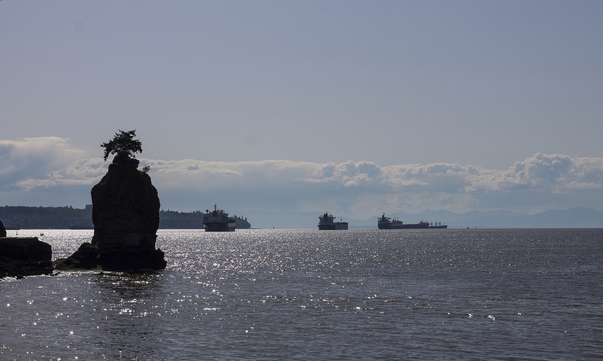
The famous Stanley Park Seawall is more than just a path; it's a Vancouver institution. This 9-kilometer (5.6-mile) loop around the perimeter of Stanley Park offers continuous ocean and city views. You'll pass by Brockton Point Lighthouse, Siwash Rock, and the Lions Gate Bridge. It's flat, paved, and accessible year-round.
Just west of the University of British Columbia (UBC), Pacific Spirit Regional Park offers a vast network of well-maintained, mostly flat trails through lush, second-growth forest. It's a fantastic escape into nature without leaving the city. The trails are wide and shared by hikers, dog walkers, and equestrians. My personal favourite is the Camosun Bog loop for its unique ecosystem.
Ready to put in a bit more effort for some spectacular scenery? These hikes involve some elevation gain and uneven terrain, but are generally well-marked and don't require specialized gear beyond sturdy hiking shoes.
A classic North Shore hike that offers wide views of Deep Cove and Indian Arm. The trail itself is a pleasant walk through mossy forest, featuring wooden boardwalks and some gentle uphill sections. The reward is the well-known Quarry Rock viewpoint, perfect for photos and a snack break.
Part of the legendary Howe Sound Crest Trail, St. Mark's Summit offers incredible panoramic views of Howe Sound, the Tantalus Range, and the Sunshine Coast. The trail climbs steadily through old-growth forest, with some rocky sections and roots. It's a good step up from Quarry Rock in terms of exertion.
These hikes are for experienced hikers with good fitness levels. Expect significant elevation gain, steep sections, and potentially exposed areas. Proper gear, including sturdy hiking boots, layers of clothing, and sufficient water, is essential.
Affectionately (or perhaps not so affectionately) known as "Mother Nature's Stairmaster," the Grouse Grind is a 2.9-kilometer vertical climb up the face of Grouse Mountain. There are no switchbacks, just a relentless ascent of over 2,800 stairs and roots. It's a rite of passage for many Vancouverites.
While technically in Squamish (about an hour's drive north of Vancouver), "The Chief" is a must-do for any serious hiker based in the Lower Mainland. This granite monolith offers three distinct peaks, each providing increasingly spectacular views of Howe Sound, Squamish, and the surrounding mountains. The trail involves steep climbs, roots, ladders, and chains to assist with some of the more exposed sections.
Vancouver's outdoor playground is magnificent. If you are seeking a gentle stroll or a lung-busting ascent, there's a trail here waiting to be explored. So, grab your gear, embrace the fresh air, and discover the natural beauty that makes this city so unique. Happy hiking!
The Stanley Park Seawall is perfect for families, offering paved paths, minimal elevation, and striking ocean views. Pacific Spirit Regional Park also has many easy, forested trails.
For easy and some moderate hikes like Quarry Rock or the Grouse Grind, you can use TransLink (SkyTrain, SeaBus, bus). For St. Mark's Summit and especially The Chief, a car is highly recommended as public transit options are limited or non-existent.
Canadian prices are in CAD, exchange rates vary. Border crossings (Peace Arch) can have waits; NEXUS is recommended for frequent travelers. Many trailheads have paid parking. Always check weather, carry bear spray on mountain trails, and inform someone of your plans.
More BC camping
 English
 Español
 Français
 Deutsch
 Українська