FanVancouver · Local guide
Guide for road-trippers on the well-known Sea-to-Sky Highway from Vancouver to Whistler. Includes stops, prices, and tips for Canadian & US visitors.
The Sea-to-Sky Highway — Highway 99 — runs about 120 km from Horseshoe Bay to Whistler along the edge of Howe Sound, and it is the drive people remember longest from a trip to British Columbia. It was rebuilt for the 2010 Olympics, so it is now a fast modern road with proper pullouts at the viewpoints, which is exactly why it is worth driving slowly. This covers every stop worth making, in the order you reach them, with parking and how long each one really takes.
My goal here is to give you the insider's guide, the kind of advice I'd give my own visiting family. We're talking practicalities, hidden gems, and how to make the most of every kilometre without getting bogged down in tourist traps or missing the spectacular. This isn't just a list; it's a carefully curated itinerary designed for road-trippers who appreciate both the journey and the destination. Let's hit the road.
Your Sea-to-Sky adventure officially begins once you leave the crowded core of Vancouver. Assuming you're starting from downtown, you'll head west on Georgia Street, eventually merging onto Highway 1 West. This initial stretch is urban, but quickly transitions into a scenic drive through West Vancouver, offering glimpses of the ocean and expensive real estate. For our American friends, remember that BC speed limits are in kilometres per hour (km/h), not miles per hour (mph). 100 km/h is roughly 60 mph.
Your first significant landmark will be Horseshoe Bay, an easygoing ferry terminal village. Even if you're not catching a BC Ferries vessel to Vancouver Island or the Sunshine Coast, it's worth a quick stop. There are clean public washrooms, a few cafes, and a lovely viewpoint over the bay. This is where Highway 99 begins its climb.
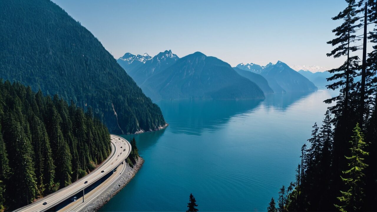
Leaving Horseshoe Bay, the highway narrows and begins its dramatic ascent. You're now on the "Sea" portion of the Sea-to-Sky, with the deep blue waters of Howe Sound on your left and rugged mountains rising steeply on your right. Keep an eye out for pull-outs; they offer fantastic photo opportunities and are much safer than stopping on the shoulder.
A pretty, affluent community clinging to the mountainside. There's not much for a road-tripper to do here beyond admire the views, but it’s a good marker that you’re making progress. The speed limit here often drops, so pay attention.
This is your first essential stop. Located directly on Howe Sound, Porteau Cove offers great panoramic views. It's a popular spot for divers (there's an artificial reef) and campers, but even a 30-minute stop is rewarding. There's a long pier perfect for strolling and watching for marine life, and it's a prime spot for photography, especially at sunset.
As you continue north, the highway eventually flattens out slightly, and you'll see the massive granite face of the Stawamus Chief rising majestically. You've arrived in Squamish, often dubbed the "Outdoor Recreation Capital of Canada." Squamish has shifted over the past two decades from a logging town to a base for climbing, hiking, mountain biking and kiteboarding, and its population has grown with it.
This is arguably the most popular attraction between Vancouver and Whistler, and for good reason. The gondola whisks you 885 meters (2,900 feet) up the side of Mount Habrich, offering absolutely striking 360-degree views of Howe Sound, the Stawamus Chief, and surrounding peaks. At the top, you'll find viewing platforms, suspension bridges, hiking trails suitable for all levels, and a restaurant.
For the more adventurous, hiking "The Chief" is a quintessential Squamish experience. There are three peaks, each offering progressively more challenging hikes and increasingly rewarding views. Even just hiking to the first peak is a significant workout, involving chains and ladders in some sections. Wear proper hiking shoes and bring plenty of water.
Don't just drive through Squamish; take a detour into its easygoing downtown. Cleveland Avenue is the main street, lined with local shops, breweries, and eateries. It's a great place to refuel.
As you leave Squamish, the landscape shifts slightly. The ocean views become less prominent, replaced by towering forests and the increasingly rugged mountain environment that signals your approach to Whistler.
Just south of Squamish, Shannon Falls is BC's third-highest waterfall, plunging 335 meters (1,100 feet) down a series of cliffs. It's incredibly accessible, with a short, paved path leading from the parking lot to the base of the falls. A perfect leg-stretcher and photo op.
Further north, closer to Whistler, Brandywine Falls offers a different perspective. A short, easy loop trail (about 15 minutes) leads to several viewpoints overlooking the spectacular 70-meter (230-foot) waterfall, often framed by a dramatic railway trestle. There are also views of Daisy Lake and the surrounding mountains.
Congratulations, you’ve made it to Whistler! As you approach, the highway widens, and you'll see signs for the various access points to Whistler Village, Blackcomb Base, and Creekside. Whistler Blackcomb is North America's largest ski resort, but it's a first-rate destination year-round, offering everything from hiking and mountain biking to fine dining and spa experiences.
This is crucial. Whistler Village is largely pedestrianized. There are numerous paid parking lots, both underground and surface. Parking can be expensive, especially in winter or peak summer.
The heart of Whistler, this pedestrian-only pathway winds through shops, restaurants, and hotels. It’s perfect for a leisurely stroll, people-watching, and soaking in the alpine atmosphere. Don't miss Olympic Plaza, especially in winter for ice skating or summer for free concerts.
If you have time and budget, the Peak 2 Peak Gondola is a must-do. It connects the tops of Whistler and Blackcomb mountains, offering unparalleled 360-degree views. It holds the world record for the longest unsupported span and highest point above ground for a lift. You can hike, dine, and explore at both summits.
Whistler offers everything from casual cafes to Michelin-starred dining experiences. Here are a few reliable options:
The Sea-to-Sky Highway is more than just a road; it's a gateway to some of British Columbia's most impressive natural beauty and busy communities. If you are chasing waterfalls, scaling mountains, or simply enjoying the unparalleled views, this drive offers a trip you'll remember. Allow more time than the map suggests. The stops, not the driving, are what the day is made of.
Break up the drive or stay the night — Squamish and Whistler both make great bases on the Sea-to-Sky corridor.
A rental car is the best way to stop at Shannon Falls and the viewpoints — compare deals here.
The direct drive from downtown Vancouver to Whistler without any stops takes approximately 1.5 to 2 hours, depending on traffic and road conditions.
No, you do not need a special pass or permit for the highway itself. However, some provincial parks along the route (like Porteau Cove or Shannon Falls) may require parking fees in the future, though currently, they are generally free for day-use. Attractions like the Sea to Sky Gondola or Peak 2 Peak Gondola require tickets.
Yes, there are gas stations in Squamish and Whistler. It's advisable to fill up in Vancouver before you leave, as prices tend to be higher further north. Don't let your tank get too low between Squamish and Whistler.
Driving is one option of several. Vancouver to Whistler by bus, shuttle or car compares them on price, time and what happens in winter.
More to explore in Vancouver
 English
 Español
 Français
 Deutsch
 Українська