ORDRE d'évacuation
Feu de forêt de Bald Range
144 propriétés en commande ; à propos de 374 personnes touchées.
District régional d'Okanagan-Similkameen, District de Summerland · 245 km de Vancouver · mis à jour le 2026-08-29
FanVancouver · Guide local
Carte des feux de forêt en direct en C.-B. (bcfiremap) : 86 feux de forêt actifs en C.-B., avec évacuations, fumée et contexte routier.
🔥 En direct · Données ouvertes du BC Wildfire Service
Chaque incendie actif dans la province sur une seule carte — puis les mesures de sécurité qui comptent vraiment pour les visiteurs de Vancouver et les voyages en Colombie-Britannique.
Au 4 octobre 2026 (UTC), les données ouvertes du BC Wildfire Service montrent 75 feux de forêt actifs en Colombie-Britannique — 1 hors de contrôle, 12 maîtrisés — brûlant environ 414 918 hectares, sur un total de 1441 feux cette saison. Le plus grand feu actif, Pear Lake, couvre environ 165 909 hectares. Les données du serveur sont actualisées toutes les 30 minutes environ.
Source : BC Wildfire Service (DataBC). La taille du marqueur varie en fonction des hectares signalés. Cliquez sur un marqueur pour obtenir le statut, la taille, la cause et le lien officiel de l'incident, le cas échéant. Carte © OpenStreetMap. Cette page est un outil FanVancouver indépendant – ce n'est pas le tableau de bord du gouvernement.
bcfiremap est ce que les gens tapent pour une carte en direct des feux de forêt en Colombie-Britannique. Cette page est cette carte pour les visiteurs : chaque feu de forêt actif provenant des données ouvertes du BC Wildfire Service, plus la fumée, l'indice de qualité de l'air et le contexte routier. Le tableau de bord du gouvernement reste la source légale pour les périmètres ; nous republions la même couche ouverte afin que vous puissiez planifier un voyage sans avoir à chercher sur trois sites officiels.
Vous y êtes : fanvancouver.com/vancouver/bc-wildfires/ — une carte en direct des feux de forêt actifs en Colombie-Britannique à partir des données ouvertes du BC Wildfire Service (DataBC). Le serveur se rafraîchit toutes les 30 minutes environ ; la carte se met à jour lorsqu'elle est ouverte. Instantané actuel des données ouvertes : 86 actifs incendies, 1 hors de contrôle.
Faites défiler jusqu'à la carte en direct sur cette page, ou ouvrez le flux lisible par machine à l'adresse /api/fv_incendies.jsonVérifiez toujours les évacuations auprès de UrgenceInfoBC et le statut officiel des feux de forêt de la Colombie-Britannique — nous republions des données ouvertes pour les voyageurs et n'émettons pas d'ordres.
Nous traçons la même couche publique d'incendies actuels utilisée par les tableaux de bord provinciaux, ainsi que le contexte des visiteurs (fumée, routes, sécurité). Pour les portails gouvernementaux, commencez à Statut des feux de forêt en Colombie-Britannique.
Pour les journalistes et les éditeurs — chiffres des incendies en direct en Colombie-Britannique
Page canonique : fanvancouver.com/vancouver/bc-wildfires/
Flux lisible par machine (même couche de données ouvertes que la carte) : /api/fv_incendies.json — actualisé toutes les 30 minutes à partir de la couche « feux en cours » du BC Wildfire Service / DataBC. Toujours revérifier État des feux de forêt en Colombie-Britannique et EmergencyInfoBC avant la publication.
Articles similaires sur FanVancouver : carte des incendies de la province · fumée et qualité de l'air · interdictions de feu · centre d'information sur les feux de forêt · notes de situation
Aussi : Cartes de l'Amérique du Nord · Carte en direct des États-Unis · Pôle Canada
La saison des incendies évolue plus vite que n'importe quelle politique de réservation. Si vos dates tombent dans une saison active, la protection pratique n'est pas une assurance — c'est une chambre que vous pouvez annuler gratuitement la veille : tarifs remboursables sur Expedia.ca →Lien d'affiliation — nous pouvons gagner une commission sans frais supplémentaires pour vous.
La fumée ne stagne pas partout pareil : le West End et Kitsilano reçoivent la brise du large en premier. Comparez sur la carte les tarifs réels des hôtels et locations, et prenez une chambre climatisée.
FanVancouver est un guide touristique indépendant. Le statut légal d'évacuation et les interdictions routières proviennent uniquement des agences mentionnées ci-dessus. Le nombre d'incendies sur cette page provient du BC Wildfire Service (données ouvertes DataBC) et est mis à jour toutes les 30 minutes environ — le chiffre en direct est celui du résumé ci-dessus.
À travers la Colombie-Britannique, 4 feux de forêt actuellement en évacuation commandes qui leur sont rattachés et 6 ont des ordres ou des alertes d'une sorte ou d'une autre. En additionnant les polygones officiels : environ 152 propriétés sont sous le coup d'un ordre (ce qui signifie "partez maintenant") et un autre 146 sont en alerte, ce qui signifie être prêt à partir en quelques minutes. Environ 386 personnes se trouvent à l'intérieur des zones ordonnées.
Les chiffres proviennent directement de la couche des zones d'urgence et d'alerte de la province, le même ensemble de données que celui utilisé par le tableau de bord officiel, et sont mis à jour ici toutes les demi-heures environ. Un commande n'est pas un conseil — vous partez. Un alerte signifie sacs emballés, véhicule plein, animaux et documents près de la porte. Que faire, dans l'ordre se trouve plus bas sur cette page.
Trié par propriétés sous ordre d'évacuation. Liste complète et délimitation exacte de chaque ordre : InfoUrgenceC.-B. · Tableau de bord du service des feux de forêt de la Colombie-BritanniqueSi votre adresse est à l'intérieur d'un ordre, le district régional — et non cette page — est l'autorité.
Ces huit incendies à eux seuls couvrent environ 378 864 hectares — environ 33 fois la superficie de la ville de Vancouver. La distance est à vol d'oiseau depuis le centre-ville de Vancouver, donc un incendie à 150 km peut encore représenter un détour de cinq heures par la route.
| Feu | Taille | Statut | Cause | De Vancouver |
|---|---|---|---|---|
| Lac PearE du lac Pear | 165 909 ha | Sous contrôle | Foudre | 211 km |
| Ainslie Creek | 69 705 ha | En cours | D'origine humaine | 141 km |
| French Bar Creek | 61 050 ha | Sous contrôle | Foudre | 228 km |
| Bonanza Creek | 34 992 ha | Sous contrôle | Éclair | 196 km |
| Bald Range | 25 163 ha | Sous contrôle | En cours d'enquête | 237 km |
| Brunswick Creek | 9 543 ha | En cours | D'origine humaine | 138 km |
| Border 2Mont Hozomeen | 6 277 ha | Aura lieu | Éclair | 156 km |
| Lac Lessard5,3 km au nord-est du lac Lessard | 6 224 ha | En cours | Éclair | 410 km |
Les tailles sont les estimations du BC Wildfire Service et sont mesurées à nouveau depuis les airs, donc un chiffre qui double du jour au lendemain signifie généralement que l'incendie a été cartographié correctement, et non qu'il a doublé. « Maîtrisé » signifie qu'il ne devrait pas dépasser les lignes de contrôle existantes dans les conditions actuelles — et non qu'il est éteint. Touchez le nom d'un incendie pour la page officielle de l'incident.
Bulletins et photographies republiés du BC Wildfire Service et du BC Gov News sous la Licence du gouvernement ouvert – Colombie-Britannique © Province de la Colombie-Britannique.
Les titres renvoient directement à l'éditeur. FanVancouver est un guide touristique indépendant, pas un diffuseur d'urgence — en cas de situation mettant en jeu la sécurité des personnes, suivez les alertes d'urgence de la Colombie-Britannique sur votre téléphone et celles de votre district régional, pas un site Web.
Cette page est la carte des incendies de la Colombie-Britannique destinée aux visiteurs : dénombrements en direct, ordres d'évacuation, les huit plus grands incendies, la fumée/l'IQAA et le contexte routier, actualisés toutes les 30 minutes environ à partir des mêmes données ouvertes utilisées par la province. Le tableau de bord officiel des incidents (épingles, périmètres, pages des incendies importants) est wildfiresituation.nrs.gov.bc.ca/mapUtilisez-le si vous avez besoin du polygone exact pour une adresse ; utilisez cette page si vous avez besoin de la version visiteur — puis-je me rendre à Kelowna en voiture, Vancouver est-elle enfumée, un feu de camp est-il légal.
Une brève note lorsque la carte ou le calendrier du week-end est mis à jour. Pas d'envoi quotidien. Désabonnez-vous à tout moment.
Vancouver en ce moment
Les randonnées sur les crêtes, Grouse et le Chief sont bonnes aujourd'hui – l'air n'est pas le facteur limitant.
Pire air en Colombie-Britannique
Tout ce qui est de 7 ou plus signifie que les personnes asthmatiques, celles souffrant de problèmes cardiaques, les jeunes enfants et les personnes âgées devraient réduire leur temps passé à l'extérieur — et pas seulement les athlètes.
Vancouver lit 1 — faible risque — et le maximum provincial est 3 à Victoria. La fumée est généralisée aujourd'hui plutôt que confinée à une seule vallée. Les prévisions d'Environnement Canada annoncent une hausse à Vancouver d'environ 2 dans les 24 heures.
Échelle : 1–3 faible · 4–6 modéré · 7-10 haut · Plus de 10 très élevé. Les lectures sont les observations horaires de l'indice de qualité de l'air ambiant (IQAA) publiées par Environnement et Changement climatique Canada pour chaque communauté déclarante ; tout ce qui est supérieur à 10 est signalé comme 10+. Les valeurs sont actualisées ici toutes les demi-heures environ. Tableau provincial complet : IQ Air Canada · prévision du panache de fumée : FireSmoke CanadaAlternatives intérieures et en cas de pluie : Plan d'activités à Vancouver en cas de mauvais temps.
Guide complet de fermeture des campings de l'Okanagan (Westside / Fintry / Bear Creek)
📰 Compte rendu des nouvelles sur les feux de forêt en C.-B. + article partageable →
Tiré du flux en direct lorsque la province les signale.
Le Vancouver urbain ne fait presque jamais face à des flammes directes. Les jours enfumés signifient brume, couchers de soleil orangés et respiration plus difficile dans les collines — pas une annulation automatique. Pivotez avec Aujourd'hui et Ce soir.
La vue meurt en premier. Si l'IQAA est élevé, évitez les longues crêtes exposées. Les projets de ferry + côte ouest nécessitent toujours des interdictions + des contrôles de fumée — commencez par la Pôle des villes de la Colombie-Britannique.
Considérez DriveBC comme obligatoire. Un incendie « loin de Vancouver » peut toujours fermer la seule autoroute menant à votre chalet. Prévoyez un plan B pour passer la nuit dans une ville plus grande.
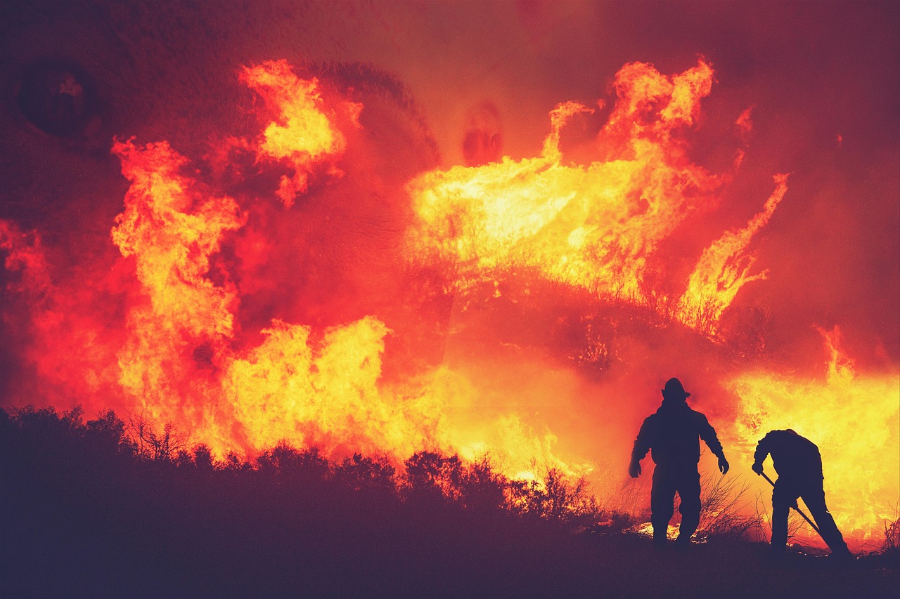
Le risque d'incendie direct pour la ville est très faible ; l'histoire ici est fumée dérivante et des incendies de forêt occasionnels à proximité de Squamish et de Lions Bay. L'autoroute Sea-to-Sky ferme rarement en cas d'incendie, mais vérifiez DriveBC les jours de grand vent et de fumée avant de s'engager dans Whistler ou Squamish.
La côte ouest humide est celle qui brûle le moins. Même lors des mauvaises années à l'intérieur des terres, Tofino et Ucluelet restent souvent claires — les excursions sur les îles sont la solution classique pour échapper à la fumée. La région des lacs du centre de l'île peut encore connaître des incendies locaux ; les trajets en ferry eux-mêmes ne sont pratiquement jamais annulés en raison de la fumée.
C'est là que les incendies les plus importants de la Colombie-Britannique se sont habituellement déclarés — et depuis début août 2026, l'approche Westside Road / Bear Creek–Fintry depuis Kelowna ainsi que le corridor Kamloops–Vernon ont été parmi les perturbations les plus impactantes pour les visiteurs — Kelowna
Les feux éloignés peuvent brûler pendant des mois et propager de la fumée dans toute la province sans menacer aucune ville touristique. Regarder firesmoke.ca pour savoir où va le panache — c'est plus important pour votre voyage que le point de l'incendie sur la carte.
La Colombie-Britannique utilise l'indice de qualité de l'air. Un chiffre, vérifié chaque matin, vous indique l'intensité de l'effort à fournir à l'extérieur :
| IQAA | Niveau | Ce que cela signifie pour votre journée |
|---|---|---|
| 1–3 | Faible | Tout est possible — Grouse Grind, randonnées sur les crêtes, longues balades. |
| 4–6 | Modéré | Convient à la plupart des gens ; les groupes sensibles réduisent les efforts intenses. La vue commence à s'embuer. |
| 7–10 | Élevé | Échangez les jours de sommet contre des jours de ville. Les courtes promenades sont acceptables ; évitez le cardio soutenu à l'extérieur. |
| 10+ | Très élevé | Journée en intérieur. Musées, marchés gourmands, aquarium — voir le Plan B ci-dessous. |
Vérifiez le numéro en direct sur Page de l'IQAA de la Colombie-Britannique d'Environnement Canada — les matins sont généralement plus clairs que la fin d'après-midi les jours de fumée.
Les épisodes de fumée dans le Metro Vancouver durent généralement un à trois jours, jusqu'à ce que le vent tourne. Vous n'avez pas besoin d'annuler — vous avez besoin d'une liste de pivot:
Kit complet pour la salle de presse (comptages en direct, iframe, badge IQA, JSON) : fanvancouver.com/embed/.
Les salles de rédaction et les blogs de voyage peuvent intégrer la carte en direct gratuitement — elle se met à jour toutes les 30 minutes à partir des données ouvertes du BC Wildfire Service. Copier-coller:
L'attribution est intégrée au widget. Questions ou tailles personnalisées : nous joindre.
Empreinte plus petite? Le badge de l'indice de qualité de l'air en direct (Qualité de l'air de Vancouver maintenant + la pire de la Colombie-Britannique), mêmes termes gratuits :
Cette page est une couche destinée aux visiteurs sur les données ouvertes provinciales : points d'incendie actifs, langage d'état et liens pratiques pour la fumée, les routes et les règles concernant les feux de camp. C'est non un substitut aux alertes d'urgence nationales (Alert Ready), aux informations d'urgence de la Colombie-Britannique (EmergencyInfoBC) ou aux ordres d'évacuation des autorités locales. Si vous êtes sous le coup d'une alerte ou d'un ordre d'évacuation, suivez uniquement les instructions officielles.
Hors de contrôle signifie que l'incendie devrait continuer à s'étendre au-delà de ses limites actuelles dans les conditions actuelles – et non que Vancouver est en feu. En cours signifie qu'aucune croissance n'est prévue dans les conditions actuelles. Sous contrôle signifie que les lignes de confinement devraient tenir. Le « Feu d'intérêt » signale les feux d'intérêt public (taille, proximité des communautés, fumée ou valeurs à risque).
La plupart des feux actifs brûlent loin du centre-ville de Vancouver. Ce qui atteint occasionnellement la ville est fumée susceptible d'annuler les randonnées en montagne, de dégrader les vues sur le coucher de soleil et d'irriter les poumons. Pour les excursions d'une journée (Whistler, Sea-to-Sky, Fraser Valley, Okanagan), consultez cette carte ainsi que les outils routiers/aériens — un matin clair à Kitsilano ne garantit pas un air clair en altitude à l'intérieur des terres.
Instantané des données utilisées pour les comptes sur la page : actif=86, total_saison=1437, mis_à_jour=2026-10-01T12:30. Les comptes sur les puces statistiques sont mis à jour à partir de /api/fv_fires.json dans le navigateur.
Presque jamais. La plupart des feux actifs brûlent à l'intérieur des terres, au nord et dans les forêts reculées. Ce qui atteint habituellement le Grand Vancouver, c'est la fumée certains jours d'été/début d'automne lorsque les vents s'alignent.
La même couche de feux actuels ouverte par le BC Wildfire Service / DataBC utilisée par le tableau de bord provincial. Notre serveur se rafraîchit toutes les 30 minutes environ; cette page se rafraîchit toutes les 10 minutes environ lorsqu'elle est ouverte.
Statut de suppression : le feu devrait continuer à s'étendre au-delà des limites actuelles. Ce n'est pas un ordre automatique de quitter Vancouver. « Maîtrisé » = croissance non prévue ; « Sous contrôle » = les lignes de confinement tiennent.
Généralement non — mais vérifiez toujours DriveBC pour les fermetures, firesmoke.ca/AQHI pour la qualité de l'air, et les alertes d'évacuation officielles si vous conduisez près de zones d'incendie actives. La fumée peut rendre les vues sur la montagne sans intérêt même lorsque les routes sont ouvertes.
Vérifiez d'abord l'indice de qualité de l'air ambiant. Évitez les longues randonnées en crête. Préférez les musées intérieurs, les marchés et les courtes promenades le long de la digue. Groupes sensibles (enfants, personnes âgées, asthmatiques) : réduisez les efforts en extérieur ; un respirateur bien ajusté aide certaines personnes à l'extérieur.
Consultez la carte en direct en haut de cette page — elle affiche chaque incendie actif à partir des données du BC Wildfire Service, rafraîchies toutes les 30 minutes environ. La plupart des saisons, les incendies restent bien en dehors de la région métropolitaine de Vancouver; la fumée, et non les flammes, est ce qui atteint occasionnellement la ville.
Officiellement d'avril à octobre. Pour les visiteurs, la période la plus intéressante se situe de la mi-juillet au début septembre, lorsque l'activité des incendies et les épisodes de fumée sont à leur maximum. Les voyages en septembre permettent généralement d'éviter le pire ; à partir d'octobre, ce n'est plus un problème.
Très rarement. YVR fonctionne normalement lors d'épisodes de fumée typiques ; les retards liés à la visibilité sont rares et brefs. Les petits hydravions et les vols régionaux (port-à-port, Tofino) sont plus sensibles — vérifiez auprès de l'opérateur les jours de forte fumée.
Appelez le 1-800-663-5555 ou le *5555 depuis un téléphone portable en C.-B. — gratuit, 24h/24 et 7j/7. Pour les urgences vitales, composez le 911.
L'autorité provinciale est BC Wildfire Service. Cette page FanVancouver trace la même couche de feux en cours pour les visiteurs, avec un contexte de sécurité. Préférez toujours les tableaux de bord officiels et Alert Ready lors des urgences. Nombre actif lors de notre dernière actualisation du serveur : 86 (1 hors de contrôle). Les chiffres sont mis à jour toutes les 30 minutes à partir des données ouvertes de BC Wildfire.
Notre flux en direct montre actuellement 86 incendies actifs (mis à jour le 2026-10-01T12:30). Le nombre varie au cours de la journée — utilisez les puces de la carte en haut de cette page pour un rafraîchissement côté client plus récent.
Pour les panaches de fumée et les prévisions, utilisez firesmoke.ca et l'indice de qualité de l'air d'Environnement Canada (IQAI). Notre carte des feux de forêt indique l'emplacement des incendies ; les outils de suivi de la fumée indiquent l'impact sur la qualité de l'air pour les randonneurs et les visiteurs de la ville.
Prévoyez des activités intérieures flexibles, un masque N95/KN95 si vous êtes sensible, des gouttes pour les yeux, de l'eau supplémentaire et des cartes hors ligne en cas de congestion cellulaire près des incidents. Prévoyez des jours de battement pour les voyages en voiture qui traversent l'intérieur de juillet à septembre.
Guide indépendant FanVancouver · Mis à jour le 2026-10-01 · Images d'ambiance génériques ; les positions en direct proviennent uniquement des données ouvertes du BC Wildfire Service · Sources · Feux de camp · Interdictions de feu
Les choix de FanVancouver
Hôtels, circuits et transferts en un seul endroit — nous pouvons gagner une commission, vous payez le même prix.
Certains liens sont des liens d'affiliation — nous pouvons gagner une commission sans frais supplémentaires pour vous. Confirmez les prix en direct sur le site du partenaire.
FanVancouver est écrit et géré par une seule personne — Alex, à Vancouver, en Colombie-Britannique. J'ai déménagé ici depuis l'Ukraine, je suis resté et j'écris ce site depuis 2024. Il n'y a pas de salle de rédaction derrière et aucun office de tourisme ne paie pour le contenu.
Cette page n'est pas saisie à la main : elle est reconstruite à partir de sources officielles — BC Wildfire Service, Environnement et Changement climatique Canada, DriveBC et TransLink — et chaque chiffre indique son heure d'observation. Lorsqu'une source devient silencieuse, la page l'indique également, au lieu d'afficher un chiffre obsolète comme s'il était actuel.
Le 10 août 2026, Newsweek a publié une carte des incendies en Amérique du Nord de la NASA/FIRMS et des décomptes officiels. Cette page reconstitue les mêmes chiffres publics du BC Wildfire Service. Newsweek n'a pas nommé FanVancouver.
Comment le site est recherché est défini sur la page À proposQuelque chose ne va pas, est obsolète ou manquant ? Écrivez à [email protected] — les corrections sont apportées.
Plus sur les feux de forêt en C.-B.