FanVancouver · Local guide
When wildfire smoke affects Vancouver, you need to know how to protect your health and what steps to take for your safety.
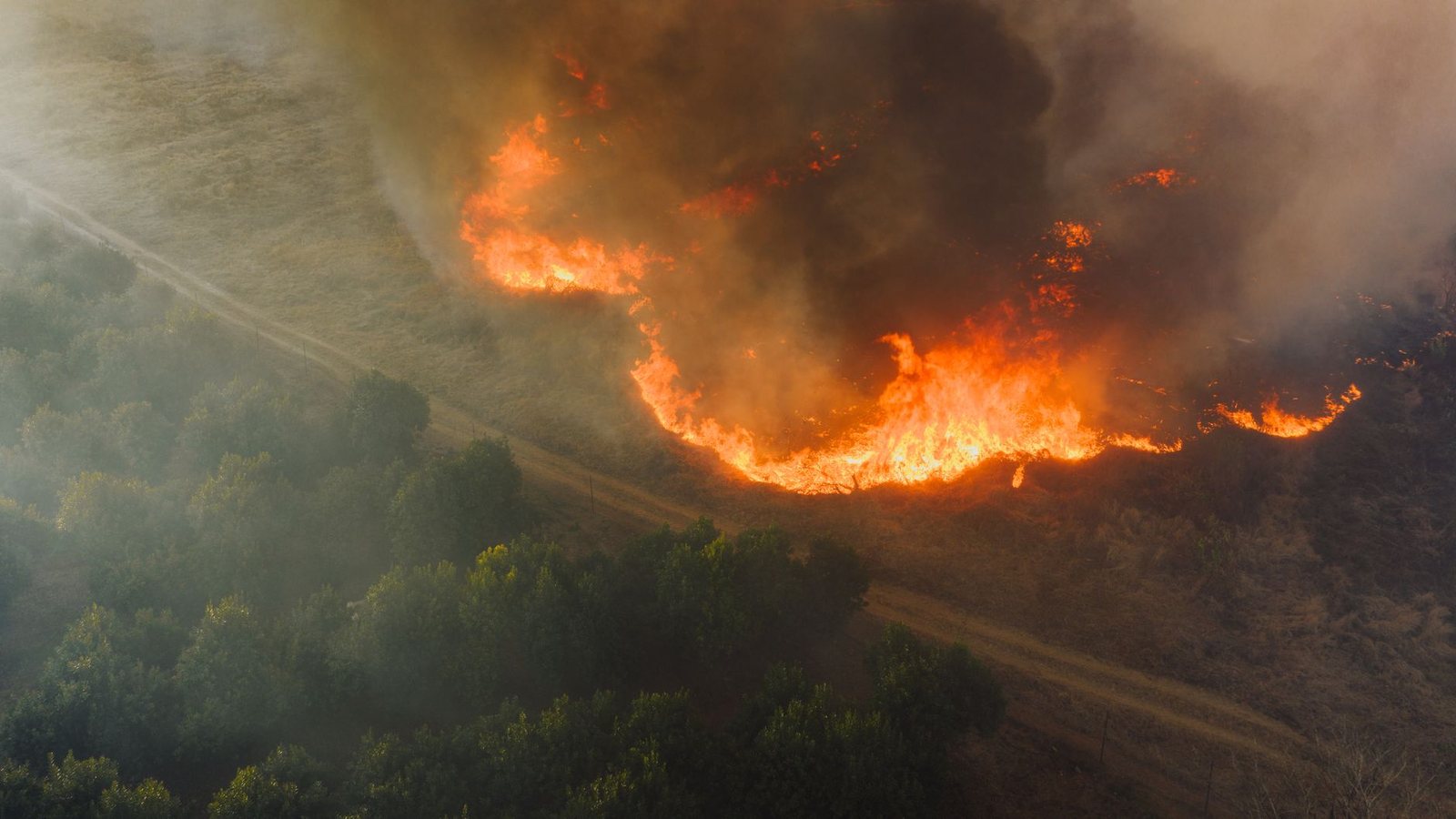
When Interior fires send smoke to Metro Vancouver: AQHI, what to cancel, masks, and when mountain views are a lost cause. Linked to live fire map.
Smoke sits differently in different neighbourhoods — the West End and Kitsilano catch the ocean breeze first. Compare live hotel and rental rates on the map, and take a room with air conditioning.
Affiliate links: we may earn a commission at no extra cost to you. Always confirm the price on the partner site.
North & West Vancouver is reading AQHI 2.15 — low risk. Low health risk from air pollution. Usual outdoor activities are generally suitable. Air quality does not tell you whether a trail or road is open. Check weather warnings, park notices and DriveBC before setting out.
| Where | AQHI now | Risk |
|---|---|---|
| North & West Vancouver Metro Vancouver - NW | 2.15 | Low risk |
| Downtown, Richmond, YVR Metro Vancouver - SW | 2.05 | Low risk |
| Burnaby, New West, Surrey Metro Vancouver - SE | 1.70 | Low risk |
| Coquitlam, Pitt Meadows, Maple Ridge Metro Vancouver - NE | 1.47 | Low risk |
Forecast peak: AQHI 2 (low risk) around 1:00 AM PCT Thursday 19 November 2026, per the same Environment Canada bulletin.
Live from the Environment and Climate Change Canada AQHI feed — observation 10:00 AM PCT Wednesday 18 November 2026, re-read by this page roughly every half hour. The index runs 1–10+ and is a health-risk score, not a particle count: 1–3 low, 4–6 moderate, 7–10 high, above 10 very high. Metro Vancouver issues its own advisories on top of it, and the four quadrants can differ by several points on a smoky day — the North Shore usually clears first when a westerly comes in.
Health guidance: ECCC health guidance.
Even when Vancouver is far from flame, Interior plumes can trash ridge hikes, outdoor tickets, and lungs. Check AQHI before you climb Grouse or drive the Sea-to-Sky for “the view.”
Smoke arrives on a wind shift, not on a schedule, and one bad air day can move a whole trip a week later. On most Vancouver hotels a cancellable rate costs the same as a locked one: rooms with free cancellation →Affiliate link — we may earn a commission at no extra cost to you.
The Air Quality Health Index (AQHI) describes the health risk from air pollution. Use the latest reading and forecast for your destination. Check trail or road status and visibility separately. Official AQHI health guidance.
| AQHI | Risk | What a visitor should actually do |
|---|---|---|
| 1–3 | Low | Usual outdoor activities are generally fine. Check local conditions before heading out. |
| 4–6 | Moderate | Most people can follow their usual plans unless they have symptoms. If you’re at higher risk and have symptoms, ease off or move strenuous activities to another time. |
| 7–10 | High | If you’re at higher risk, cut back on strenuous activity outdoors or reschedule it. Others should consider doing the same if they have symptoms. |
| 10+ | Very high | If you’re at higher risk, avoid strenuous outdoor activity. Everyone else should ease off or reschedule strenuous activity, especially if symptoms develop. |
Metro Vancouver issues advisories for the Lower Fraser Valley separately from the provincial AQHI stations, and the Fraser Valley east of Abbotsford is regularly worse than downtown Vancouver on the same day.
The pollutant of concern is PM2.5 — particles under 2.5 micrometres. Two things follow from that, and both surprise people:
In a rental car, set ventilation to recirculate rather than fresh-air intake. In a rental apartment with no purifier, a box fan with a furnace filter taped to the intake side is a crude but genuinely effective substitute for a few smoky days.
Healthy adults tolerate a few smoky days with, at worst, a scratchy throat and tired eyes. The groups that should take an advisory literally are children, travellers over 65, people who are pregnant, and anyone with asthma, COPD or a heart condition. If you use a rescue inhaler at home, carry it in your day bag rather than leaving it at the hotel — smoke episodes escalate over hours, not days.
Smoke takes the mountains away first. The Sea-to-Sky, Grouse, the Chief and every viewpoint north of the harbour become a grey wall, and the money spent on a gondola ticket buys nothing. What survives smoke well is anything indoors and anything at sea level with low exertion:
Our what to do in Vancouver today page is built for exactly this decision, and the live fire map tells you whether the source is close enough to persist.
Metro Vancouver's smoky days cluster from late July to mid-September and depend less on how bad the fire season is than on wind direction: it takes easterly or northeasterly flow to push Interior smoke down the Fraser Valley. A severe fire year with persistent westerly flow can leave the coast clear all summer. That is why forecasting smoke more than about three days ahead is not possible, and why no honest page will tell you in advance whether your August week will be affected.
It depends on local air quality, how much time you’ll spend outdoors and your health. Check the AQHI and local advisories before leaving. Keep an indoor option with cleaner air, especially if you or someone in your group is at higher risk.
If you need to be outside, a well-fitting N95 or equivalent respirator can reduce exposure to fine smoke particles. Smoke gases can still pass through. Cutting exposure and finding cleaner air remain important.
Check the AQHI near your destination, the operator’s status and a recent webcam before leaving. Use the AQHI to decide how much exertion makes sense. If the view is your main reason to go, check visibility and your ticket’s change policy separately.
Smoke can reach Vancouver when winds carry it from active fires in B.C. or farther away. Its arrival and duration vary. Before your trip, use the local air-quality forecast and the FireSmoke Canada plume forecast.
Use Environment and Climate Change Canada for the local AQHI and forecast. Metro Vancouver’s AirMap shows station readings and regional air-quality warnings. FireSmoke Canada shows where smoke may travel.
Canonical page: fanvancouver.com/bc/wildfire-smoke-vancouver/
Machine-readable AQHI readings: /api/fv_aqhi.json — station name, observed value and observation time, refreshed hourly.
Source is the Environment and Climate Change Canada AQHI service (api.weather.gc.ca), 27 B.C. stations. We republish the readings and add no assessment of our own; for the fire side of the story see our live BC wildfire page.
FanVancouver is written and run by one person — Alex, in Vancouver, British Columbia. I moved here from Ukraine, stayed, and have been writing this site since 2024. There is no newsroom behind it and no tourist board paying for the copy.
This page is not typed by hand: it rebuilds from official sources — BC Wildfire Service, Environment and Climate Change Canada, DriveBC and TransLink — and every figure carries its observation time. When a source goes quiet, the page says that too, instead of showing a stale number as if it were current.
How the site is researched is set out on the about page. Something wrong, out of date or missing? Write to [email protected] — corrections get made.
More on BC wildfires
 English
 Español
 Français
 Deutsch