English
 Español
 Français
 Deutsch
 Українська
Safest neighbourhoods by the numbers: the West Side — Kerrisdale, Dunbar–Southlands, West Point Grey, Arbutus Ridge and Shaughnessy together logged 1,260 reported crimes in twelve months, 3.9% of the city’s total.
Highest counts: downtown (the Central Business District) with 10,200 — 32% of all reported crime — most of it shoplifting and car break-ins, not violence.
Where caution is genuinely warranted: the Downtown Eastside — East Hastings Street from roughly Abbott to Princess. Downtown, Strathcona and the West End account for 59% of the city’s offences against a person.
For visitors: the West End, Coal Harbour, Yaletown and Kitsilano are the calm, walkable bases. Citywide, reported crime was roughly flat on the year before.
Every list of “Vancouver areas to avoid” says the same thing about the same few blocks, and then stops. What almost nobody publishes is the rest of the map: what the police actually record in each of the city’s neighbourhoods, what kind of crime it is, and whether it is getting better or worse.
The Vancouver Police Department releases every reported incident as open data — type, month, hundred-block and neighbourhood. This page takes the latest twelve complete months, September 2025 to August 2026, compares them with the twelve before, and turns 32,171 reported crimes into something a visitor, a new resident or a nervous parent can actually use. It is refreshed every week when VPD updates the data. For the practical side — transit at night, scams, the blocks visitors should skip — see our Vancouver safety guide and areas to avoid.
Where to stay in Vancouver
The calmest bases for a first visit — the West End, Coal Harbour, Yaletown and Kitsilano — are also the most walkable. Compare live hotel and rental rates by neighbourhood before you book.
Read this before the table
Crime statistics by neighbourhood are easy to misread, and most sites that publish rankings misread them. Four things matter here.
- These are raw counts, not rates. Downtown has the most reported crime because it has the most people in it — residents, a daily wave of commuters, shoppers, visitors and nightlife. A count is a measure of activity as much as of risk. We do not divide by resident population, because the people exposed to downtown crime are mostly not the people who live there.
- VPD’s “Central Business District” is huge. It rolls Gastown, Yaletown, Coal Harbour, the Granville entertainment district and the western half of Chinatown into one number. The streets inside it are very different places, which is why the neighbourhood sections below go street by street.
- Most of it is theft. “Other theft” — the catch-all that covers theft from shops and of personal belongings — is 46% of everything recorded. Theft from vehicles adds another 18%.
- It is reported crime only, and it covers the City of Vancouver alone. Burnaby, Richmond, North and West Vancouver and Surrey have their own police forces and are covered at the end.
All 24 neighbourhoods, ranked
Ranked from the most reported crimes to the fewest. “Against a person” is VPD’s category for assaults and other violent offences — the closest the data comes to a measure of personal danger, and the column to read first.
| # | Neighbourhood | Crimes | vs prior year | Against a person | Share of city | Most common |
|---|---|---|---|---|---|---|
| 1 | Downtown (Central Business District) | 10,200 | −8% | 971 | 31.7% | Other theft (incl. shops) |
| 2 | West End | 2,649 | +2% | 337 | 8.2% | Other theft (incl. shops) |
| 3 | Strathcona | 2,642 | +22% | 452 | 8.2% | Other theft (incl. shops) |
| 4 | Renfrew–Collingwood | 2,223 | 0% | 137 | 6.9% | Other theft (incl. shops) |
| 5 | Mount Pleasant | 2,176 | +14% | 130 | 6.8% | Other theft (incl. shops) |
| 6 | Kensington–Cedar Cottage | 1,720 | +22% | 118 | 5.3% | Other theft (incl. shops) |
| 7 | Fairview | 1,476 | 0% | 86 | 4.6% | Other theft (incl. shops) |
| 8 | Grandview–Woodland | 1,402 | −2% | 173 | 4.4% | Other theft (incl. shops) |
| 9 | Sunset | 1,156 | +10% | 74 | 3.6% | Other theft (incl. shops) |
| 10 | Kitsilano | 1,108 | −4% | 56 | 3.4% | Other theft (incl. shops) |
| 11 | Hastings–Sunrise | 973 | +16% | 67 | 3.0% | Other theft (incl. shops) |
| 12 | Marpole | 791 | +8% | 57 | 2.5% | Other theft (incl. shops) |
| 13 | Riley Park | 617 | +24% | 31 | 1.9% | Other theft (incl. shops) |
| 14 | Victoria–Fraserview | 497 | −1% | 59 | 1.5% | Theft from vehicle |
| 15 | Killarney | 444 | +5% | 48 | 1.4% | Other theft (incl. shops) |
| 16 | Oakridge | 327 | +10% | 25 | 1.0% | Other theft (incl. shops) |
| 17 | South Cambie | 318 | +1% | 21 | 1.0% | Other theft (incl. shops) |
| 18 | Kerrisdale | 300 | −12% | 15 | 0.9% | Other theft (incl. shops) |
| 19 | West Point Grey | 272 | +34% | 16 | 0.8% | Other theft (incl. shops) |
| 20 | Dunbar–Southlands | 271 | +12% | 18 | 0.8% | Other theft (incl. shops) |
| 21 | Arbutus Ridge | 210 | 0% | 11 | 0.7% | Other theft (incl. shops) |
| 22 | Shaughnessy | 207 | +2% | 24 | 0.6% | Theft from vehicle |
| 23 | Stanley Park | 162 | +15% | 11 | 0.5% | Theft from vehicle |
| 24 | Musqueam | 28 | +8% | 21 | 0.1% | Offence against a person |
| City of Vancouver | 32,171 | +2% | 2,960 | 100% | Other theft |
The five neighbourhoods with the fewest reports, leaving aside Stanley Park and the small Musqueam reserve: Shaughnessy (207), Arbutus Ridge (210), Dunbar–Southlands (271), West Point Grey (272), Kerrisdale (300).
What the data actually shows
Crime follows shopping, not darkness
The busiest single block in the whole city is downtown: the 700 block of West Georgia Street, home of the Pacific Centre mall, with 952 reports in twelve months. Run down the list of each neighbourhood’s busiest blocks and the pattern repeats: malls, supermarkets, big-box stores and transit hubs. In Renfrew–Collingwood, 786 reports — 35% of the neighbourhood’s total — were logged on a single stretch: the 3100 block of Grandview Highway, a big-box retail block. In Sunset, 440 reports — 38% of the neighbourhood’s total — were logged on a single stretch: the 300 block of Southeast Marine Drive, a big-box retail block. VPD publishes no locations for violent offences, so these are property-crime counts, and the blocks at the top of each list are not dangerous streets. They are places where a great deal of merchandise meets a great many people, and every shoplifting report is pinned to that block.
The same pattern shows up in the clock. Of property crimes with a recorded time, 78% happened between 6 am and 10 pm — shop hours and commuting hours. The small hours account for a minority of reports.
Violence is concentrated in a small area
Offences against a person tell a sharper story than the totals. Downtown, Strathcona and the West End together recorded 1,760 of the city’s 2,960 — 59%. VPD does not publish where those offences happen, but police and city reporting point the same way: the Downtown Eastside and the late-night entertainment district on Granville Street. Across most of the rest of the city the numbers are low: Kitsilano, one of the busiest visitor neighbourhoods outside downtown, recorded 56 in twelve months, about one a week. The city recorded 11 homicides in the same period.
Car break-ins are the crime visitors actually meet
Theft from vehicles: 5,847 reports in twelve months, about 16 a day, up 10% on the year before. It is the crime most likely to touch a visitor, and the one most completely under your control: leave nothing visible in a parked car, including charging cables, bags and coins. Rental cars and out-of-province plates are targeted precisely because they tend to have luggage inside.
Which way things are moving
Citywide, reported crime was roughly flat on the year before. Among neighbourhoods with at least 300 reports in the earlier year, the biggest increases were in Riley Park (+24%), Kensington–Cedar Cottage (+22%) and Strathcona (+22%); the biggest falls were in Kerrisdale (−12%) and downtown (−8%). Treat single-year swings in smaller neighbourhoods with caution. West Point Grey’s +34%, for example, is a change from 203 reports to 272 — a small number moving, not a crime wave.
Is downtown Vancouver safe?
VPD data, Sep 2025 – Aug 2026 Downtown (Central Business District): 10,200 reported crimes (31.7% of the city, down 8% year on year), of which 971 were offences against a person.
For a visitor, downtown Vancouver is safe in the way most big-city downtowns are safe: busy, well lit, heavily policed, with a real property-crime problem and a visible street-disorder problem concentrated in a few specific blocks. The headline number is the largest in the city because this one VPD neighbourhood contains the financial district, the main shopping streets, the entertainment district, Gastown, Yaletown and Coal Harbour, and because it is where most of the region comes to work, shop and go out.
Two parts of it deserve attention. The first is the eastern edge, where Hastings Street runs past Abbott and Carrall towards Main — the start of the Downtown Eastside, covered below. The second is Granville Street between Robson and Davie after midnight on weekends, the entertainment district, where the bars empty onto the same few blocks and where much of downtown’s late-night violence and police attention is concentrated. Neither is a reason to avoid downtown. Both are reasons to know where you are walking at 1 am.
Is Gastown safe?
Gastown sits inside the Central Business District, so VPD publishes no separate figure. On the ground the answer depends on the block. Water Street — the Steam Clock, the cobbles, the restaurants — is one of the most visited streets in the city and is busy and comfortable from morning until late evening. The change comes one block south. Cordova and Hastings east of Cambie Street are where the Downtown Eastside begins, and walking east past Carrall Street the atmosphere changes within a single block.
The practical version: enjoy Water Street, eat in Gastown, and at the end of the night walk back west towards Waterfront Station along Water or Cordova rather than cutting south through the side streets and alleys to Hastings. See our Gastown guide for the rest.
Is Chinatown safe?
Chinatown is split down Main Street: the western half counts towards the Central Business District, the eastern half towards Strathcona. By day it is fine and very much worth the visit — the Dr. Sun Yat-Sen Classical Chinese Garden, the bakeries and barbecue shops on Keefer and Pender, the old society buildings. It also sits directly beside the Downtown Eastside, and local businesses have spent years dealing with break-ins, vandalism and street disorder. Many shops close in the early evening, and the streets empty out after dark. Go in daylight; for dinner, stick to the busier restaurants near Main and Keefer. Our Chinatown guide has the details.
Is the Downtown Eastside safe?
VPD data, Sep 2025 – Aug 2026 Strathcona: 2,642 reported crimes (8.2% of the city, up 22% year on year), of which 452 were offences against a person.
This is the area every “areas to avoid” list means. The concentration of homelessness, open drug use and untreated illness along East Hastings Street, from roughly Abbott to Princess, with Main & Hastings at its centre, is real and visible, and it is the part of the city where visitors most often feel unsafe. Most violence here involves people who live and work in the area rather than passers-by, but there is no reason for a visitor to walk these blocks at night and little reason to by day. Riding a bus along Hastings through the area is fine.
It is worth knowing why VPD’s Strathcona figure is so high: the neighbourhood boundary takes in the eastern blocks of the Downtown Eastside. Strathcona itself — the residential streets south of Hastings, the oldest houses in the city around Strathcona Park — is a quiet, historic neighbourhood with a strong community, and a very different place from the Hastings corridor a few blocks north. The figure was up 22% on the year before.
Is Yaletown safe?
Yes — it is one of the calmest parts of downtown. Yaletown is residential towers, converted warehouses with restaurant patios along Mainland and Hamilton, and the seawall along False Creek. Weekend nights on the patios are lively rather than rowdy. The recurring problem is the one shared by all of downtown: break-ins to cars, including in underground parking, and bike theft. Like Gastown it is inside the Central Business District in VPD’s data. More in our Yaletown guide.
Is Coal Harbour safe?
Coal Harbour is arguably the quietest corner of downtown: waterfront towers, the seawall running west to Stanley Park, and Canada Place and the cruise terminal at its eastern end. There is little nightlife to generate trouble. As everywhere downtown, lock bikes properly and leave nothing in cars. It is one of the best places to stay the night before a cruise — see hotels near Canada Place.
Is Robson Street safe?
Robson is the city’s main shopping street, running from the downtown core into the West End, and it is crowded from late morning until well into the evening. For personal safety it is one of the easier streets in the city. Most of what gets reported on it is theft — from the shops that line it, and from bags and pockets in the crowds. The West End’s busiest block for reports is on Robson Street (224 in twelve months) — the shopping end, not the residential streets.
Is the West End safe? And Davie Village?
VPD data, Sep 2025 – Aug 2026 West End: 2,649 reported crimes (8.2% of the city, flat year on year), of which 337 were offences against a person.
The West End is one of the densest residential neighbourhoods in North America, packed between downtown, Stanley Park and English Bay, and it is the base many visitors choose because everything is walkable. It has more reported crime than most neighbourhoods simply because so many people live and walk there; for the size of its population it is not a place that feels unsafe. Denman Street, English Bay and the streets around Stanley Park are the calmest part.
Davie Street — Davie Village, the heart of Vancouver’s LGBTQ+ community — is busy late, with bars, clubs and the rainbow crosswalks. Its eastern end, towards Granville Street, picks up the entertainment-district crowd on weekend nights and is noisier and more unpredictable after 1 am. More in our West End guide.
Is Kitsilano safe?
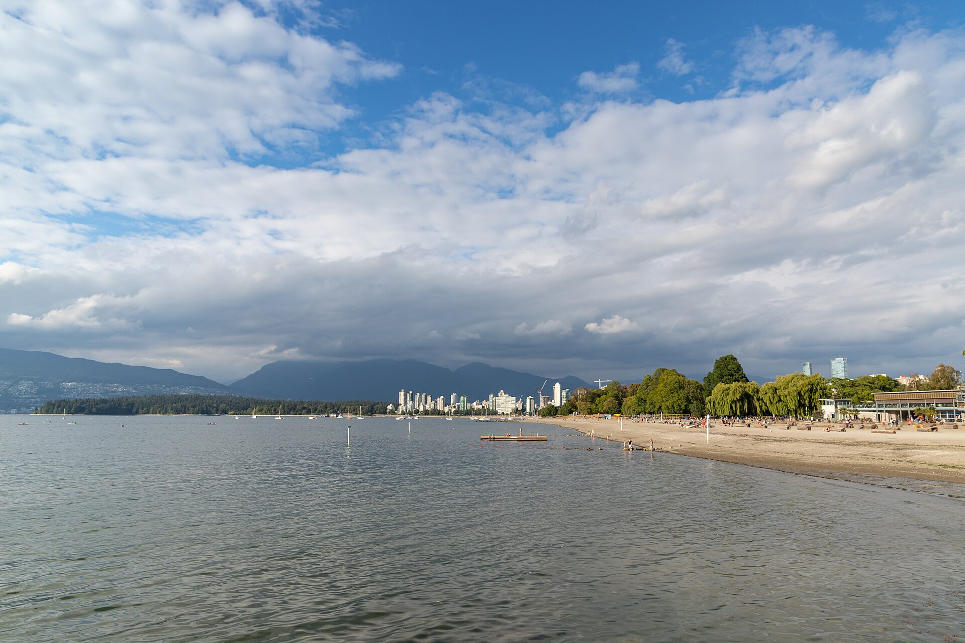
VPD data, Sep 2025 – Aug 2026 Kitsilano: 1,108 reported crimes (3.4% of the city, down 4% year on year), of which 56 were offences against a person.
Kitsilano is among the safest-feeling neighbourhoods a visitor is likely to stay in: beaches, West 4th Avenue’s shops and restaurants, and a young residential population. Its figures are a fraction of downtown’s, and offences against a person are rare. The problems are bikes and cars — the lots at Kits Beach and Kits Point are a known target for break-ins on summer days, so take everything with you. See our Kitsilano guide.
Is Mount Pleasant safe? And Olympic Village?
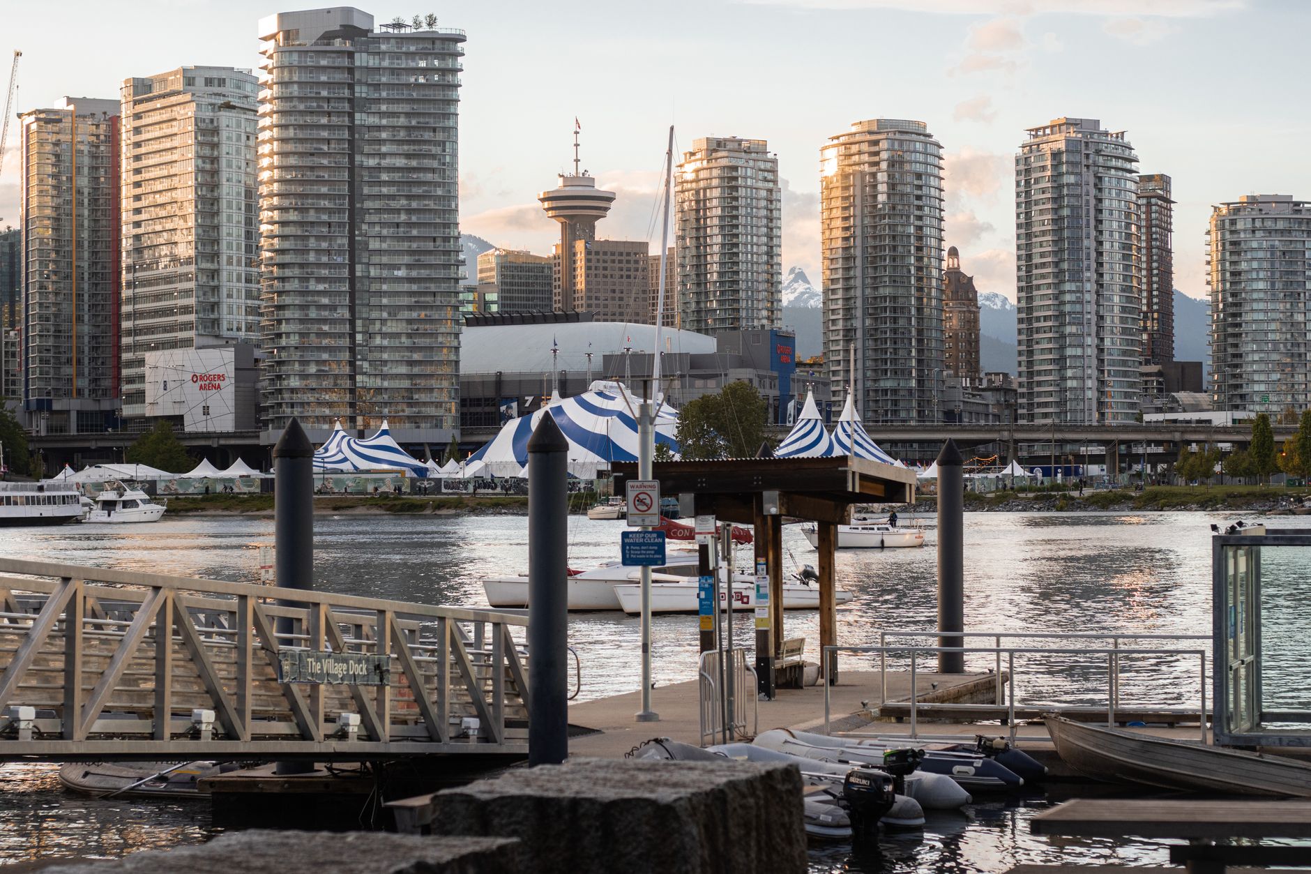
VPD data, Sep 2025 – Aug 2026 Mount Pleasant: 2,176 reported crimes (6.8% of the city, up 14% year on year), of which 130 were offences against a person.
Mount Pleasant covers Main Street’s cafés, breweries and vintage shops, the retail blocks along Cambie and Broadway, and — in VPD’s map — Olympic Village on False Creek. Main Street north of 16th Avenue is a comfortable evening strip. Olympic Village and the False Creek seawall are the calmest corner of the neighbourhood; the totals are pulled up by the busy commercial blocks around Broadway, where the new Broadway Subway construction has also made the area messier for the time being. The figure was up 14% on the year before.
Is Commercial Drive safe?
VPD data, Sep 2025 – Aug 2026 Grandview–Woodland: 1,402 reported crimes (4.4% of the city, flat year on year), of which 173 were offences against a person.
The Drive is one of Vancouver’s most local streets — Italian and Portuguese cafés, bakeries, bars and a crowd that is out until late — and it is comfortable day and evening. The busiest point for trouble is the transit hub at its southern end: Commercial–Broadway is one of the busiest SkyTrain stations in the region, and in VPD’s map its surroundings fall partly into Kensington–Cedar Cottage. At the northern end, Grandview–Woodland reaches up to East Hastings, the edge closest to the Downtown Eastside. Grandview–Woodland’s figure was roughly flat on the year before. More in our Commercial Drive guide.
Is East Vancouver safe?
VPD data, Sep 2025 – Aug 2026 Renfrew–Collingwood: 2,223 reported crimes (6.9% of the city, flat year on year), of which 137 were offences against a person
Hastings–Sunrise: 973 reported crimes (3.0% of the city, up 16% year on year), of which 67 were offences against a person
Kensington–Cedar Cottage: 1,720 reported crimes (5.3% of the city, up 22% year on year), of which 118 were offences against a person.
“East Van” is not the Downtown Eastside, and the two are constantly confused. Most of East Vancouver is ordinary residential neighbourhoods — family houses, local high streets, parks and SkyTrain stations. The totals for the eastern neighbourhoods look high for two reasons: they are large, and they contain some of the city’s biggest shopping destinations. In Renfrew–Collingwood, a single block — the 3100 block of Grandview Highway, a big-box retail block — accounts for 35% of all reports. In Kensington–Cedar Cottage, a single block — the 1700 block of East Broadway, at the Commercial–Broadway SkyTrain hub — accounts for 17% of all reports. Offences against a person in the eastern neighbourhoods are a fraction of downtown’s.
Is South Vancouver safe?
VPD data, Sep 2025 – Aug 2026 Sunset: 1,156 reported crimes (3.6% of the city, up 10% year on year), of which 74 were offences against a person
Marpole: 791 reported crimes (2.5% of the city, up 8% year on year), of which 57 were offences against a person
Victoria–Fraserview: 497 reported crimes (1.5% of the city, flat year on year), of which 59 were offences against a person
Killarney: 444 reported crimes (1.4% of the city, up 5% year on year), of which 48 were offences against a person.
South Vancouver — Sunset, Marpole, Victoria–Fraserview and Killarney — is overwhelmingly quiet residential city, from the Punjabi Market on Main Street to the Fraser River. In Sunset, a single block — the 300 block of Southeast Marine Drive, a big-box retail block — accounts for 38% of all reports. In Marpole, a single block — the 400 block of Southwest Marine Drive, the Marine Gateway shopping and transit hub — accounts for 15% of all reports. Violence figures are low. The pattern here is the suburban one: break-ins, car crime and bike theft rather than anything on the street.
Is the West Side safe?
VPD data, Sep 2025 – Aug 2026 Kerrisdale: 300 reported crimes (0.9% of the city, down 12% year on year), of which 15 were offences against a person
Dunbar–Southlands: 271 reported crimes (0.8% of the city, up 12% year on year), of which 18 were offences against a person
West Point Grey: 272 reported crimes (0.8% of the city, up 34% year on year), of which 16 were offences against a person
Arbutus Ridge: 210 reported crimes (0.7% of the city, flat year on year), of which 11 were offences against a person
Shaughnessy: 207 reported crimes (0.6% of the city, flat year on year), of which 24 were offences against a person.
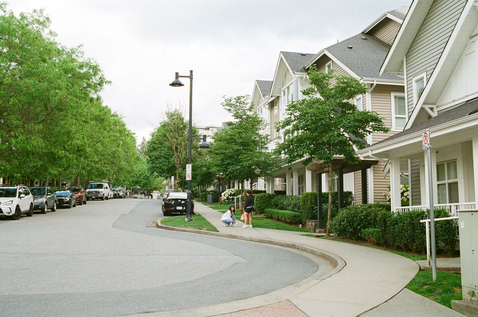
By every measure in the data, the West Side is the safest part of Vancouver: Kerrisdale, Dunbar–Southlands, West Point Grey, Arbutus Ridge and Shaughnessy together account for 3.9% of the city’s reported crime and 84 offences against a person in a year. What does happen is property crime — residential break-ins and car theft — which is why the local advice is about locked doors and garages rather than streets. For visitors the West Side is mostly for beaches, Pacific Spirit Park and UBC; hotels are few.
Is Stanley Park safe?
VPD data, Sep 2025 – Aug 2026 Stanley Park: 162 reported crimes (0.5% of the city, up 15% year on year), of which 11 were offences against a person.
Stanley Park is safe by day, and its figures are small. 43% of the reports there are thefts from vehicles — the parking lots along Stanley Park Drive and at the attractions are a magnet for break-ins, so leave nothing in the car. The seawall and the main trails are busy in daylight. After dark the interior trails are unlit and empty; keep to the seawall near English Bay or leave before dusk. Our Stanley Park guide has the rest.
Where to stay if safety is your priority
Four neighbourhoods combine low violence, easy walking and plenty of places to stay. All four are served by frequent transit, and all four are places you can walk back to after dinner without thinking about it.
West End
Residential, walkable, next to Stanley Park and English Bay. The best all-round base for a first visit; Denman and the beach end are the calmest streets.
Hotels in West End →Coal Harbour
The quietest corner of downtown: waterfront towers, the seawall and a short walk to Canada Place. Pricier, and worth it the night before a cruise.
Hotels in Coal Harbour →Yaletown
Restaurant patios and the False Creek seawall, on the Canada Line to the airport. Lively on weekend nights, rarely more than that.
Hotels in Yaletown →Kitsilano
Beaches and West 4th Avenue, fifteen minutes from downtown by bus. Fewer hotels, more rentals, and some of the lowest violence figures for any area visitors use.
Hotels in Kitsilano →One warning that saves more trips than any statistic: check the exact address before you book downtown. The cheapest listings are often on or just off East Hastings or at the eastern end of Gastown, and one or two blocks make a real difference here. Open the map, look at where the pin sits relative to Main & Hastings, and pay the extra $30 a night if you need to. Our full guide to where to stay in Vancouver compares every area.
Burnaby, Richmond, North Vancouver and Surrey
None of these are in the VPD data, because none of them are policed by VPD. Burnaby, Richmond, North Vancouver and Coquitlam are policed by the RCMP; West Vancouver, New Westminster, Port Moody and Delta have their own municipal police departments; Surrey is policed by the Surrey Police Service. Each publishes its own figures, and the categories do not match VPD’s closely enough to put them in one table without misleading you. As a rough guide, the areas visitors use most — Lonsdale and Deep Cove on the North Shore, Steveston in Richmond, Metrotown in Burnaby — are ordinary town centres and residential areas, and the same rule about parked cars applies everywhere.
How this page is built
The source is the Vancouver Police Department’s open crime data, which lists every reported incident by type, date, hundred-block and neighbourhood. We take the latest twelve complete months (Sep 2025 – Aug 2026) and compare them with the twelve months before (Sep 2024 – Aug 2025). Traffic collisions, which VPD publishes in the same file, are excluded from the crime totals. VPD withholds the location and time of offences against a person to protect privacy, so block and time-of-day figures on this page are based on property crime only. Year-on-year changes are not shown where a neighbourhood had fewer than 20 reports in the earlier period.
The data covers reported crime only — much crime, particularly minor theft, is never reported — and VPD’s neighbourhood boundaries do not always match the names people use on the street. The verdicts in each section combine the numbers with what the numbers cannot show: where the blocks change, what they feel like at night, and what locals actually do. Data last refreshed 2026-09-28. If something here is wrong, tell us and we will fix it.
Frequently asked questions
What is the safest neighbourhood in Vancouver?
By Vancouver Police data, the West Side neighbourhoods — Kerrisdale, Dunbar-Southlands, West Point Grey, Arbutus Ridge and Shaughnessy — have the fewest reported crimes: together 3.9% of the city's total in Sep 2025 – Aug 2026. For visitors, the calm and walkable bases are the West End, Coal Harbour, Yaletown and Kitsilano.
What is the most dangerous area in Vancouver?
The Downtown Eastside, centred on East Hastings Street between roughly Abbott and Princess streets, with Main & Hastings at its core. It has the city's most visible concentration of homelessness, drug use and street disorder. Downtown has the highest total crime count, but most of it is shoplifting and car break-ins.
Is Gastown safe at night?
Water Street and the main Gastown blocks are busy and comfortable in the evening. The Downtown Eastside begins one block south on Hastings Street and east of Carrall Street, so at night walk back west towards Waterfront Station along Water or Cordova rather than cutting through side streets to Hastings.
Is Yaletown safe?
Yes. Yaletown is one of the calmest parts of downtown Vancouver — residential towers, restaurant patios and the False Creek seawall. The main problem is break-ins to parked cars, including in underground garages.
Is the West End safe?
Yes. The West End has more reported crime than most neighbourhoods because it is extremely dense, but it is residential and walkable and a popular base for visitors. Denman Street and English Bay are the calmest part; the eastern end of Davie Street towards Granville is busier and rowdier late on weekend nights.
Is Kitsilano safe?
Yes. Kitsilano recorded 1,108 reported crimes in Sep 2025 – Aug 2026, a fraction of downtown's, and 56 offences against a person — about one a week. The common problems are bike theft and break-ins to cars parked at the beaches.
Is East Vancouver safe?
Most of East Vancouver is ordinary residential neighbourhoods and is not the same place as the Downtown Eastside. Its totals look high because the neighbourhoods are large and include major shopping centres and SkyTrain hubs, where much of the reported theft happens.
Is crime going up in Vancouver?
In Sep 2025 – Aug 2026, reported crime in the City of Vancouver was roughly flat on the year before: 32,171 reported crimes, about 88 a day. Theft from vehicles, the crime visitors most often meet, averaged about 16 a day.
Where should tourists stay in Vancouver for safety?
The West End, Coal Harbour, Yaletown and Kitsilano combine low violence with easy walking and plenty of hotels and rentals. Downtown, check the exact address before booking: the cheapest listings are often on or near East Hastings Street.