English
 Español
 Français
 Deutsch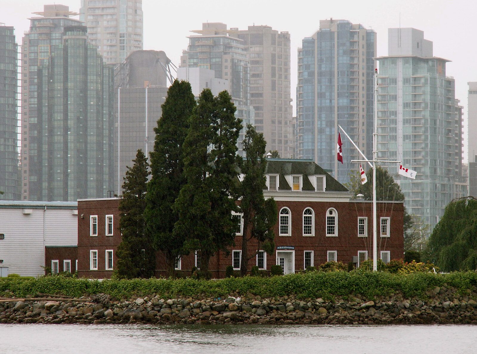
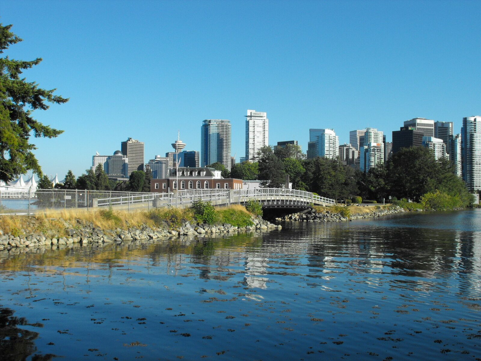
There is a small forested island joined to Stanley Park by a causeway on the Coal Harbour side, just past the marina. It has a gate, a guard, and a naval ensign. Every tour boat that passes points at it. Almost none of them tell you why it is called Deadman's Island, and the answer is not a legend at all — it is a straightforward and fairly grim municipal record.
Before the city
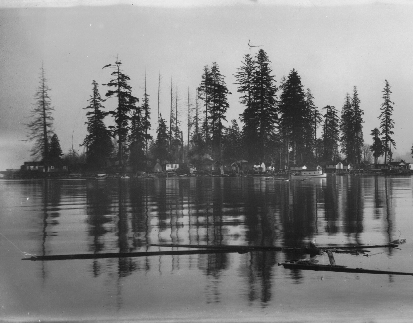
The island was a Sḵwx̱wú7mesh burial ground, and the method was tree burial: the dead were placed in red cedar boxes and the boxes were lashed high in the branches. John Morton — one of the three men who pre-empted the land that became the West End, and among the first white settlers here — described seeing hundreds of them when he came ashore in 1862. That is the first written account of the island by a European, and it is a description of a cemetery.
There is also an older account, from Chief Joe Capilano and recorded by E. Pauline Johnson in the same 1911 collection that gave us the Siwash Rock story: a siege in which two hundred young men offered their own lives in exchange for the lives of their wives and children, and were taken. It is a story about the island being paid for in people. Whether you read it as history or as the way a community remembers a catastrophe, it belongs to the same theme as everything that happened afterwards.
What the city did with it
Vancouver was incorporated in April 1886 and burned to the ground in June. Some of the dead from the Great Fire were buried on the island. Then, between roughly 1888 and 1892, the city used it as a smallpox quarantine station: the infected were taken across the water, and those who did not survive were buried where they were.
That sentence covers more than it looks like. The Great Fire took somewhere between twenty and forty-five minutes, destroyed six hundred to a thousand buildings, and killed at least twenty-one people — "at least" because much of the population was transient mill labour with nobody to report them missing.
So the name is not folklore or embroidery. Within thirty years the island held Sḵwx̱wú7mesh tree burials, fire victims, and smallpox dead, layered on maybe four hectares of ground.
The standoff of 1899
In 1899 a Vancouver businessman named Theodore Ludgate obtained a lease on the island from the federal government and announced he would build a sawmill on it. The city objected — loudly, and across party lines. The mayor and the Park Board took the position that the island was part of Stanley Park and not the federal government's to lease.
Ludgate turned up with men and axes to start clearing. The confrontation that followed involved civic officials, police and, at one point, soldiers, and it ran through the courts for years. The mill was never built. It is one of the earliest examples in this city of a public fight over whether waterfront belongs to the public, and Vancouver has been having some version of that fight ever since.
The Park Board eventually took the island over. A community of squatters lived on it through the first decades of the twentieth century, until the Second World War.
HMCS Discovery
In the war the Department of National Defence took possession and built a naval training establishment, which opened in 1944. It is still there. HMCS Discovery is Vancouver's Naval Reserve Division, an active military site, and the island is closed to the public. That is why there is a gate and why nobody has excavated it.
The consequence is that a documented burial ground with three separate populations in it sits behind a fence in the middle of a city of two and a half million people, largely undisturbed, and there is no plaque on the seawall telling you so. There is one — Centennial Plaque number 18 — but you have to know to look for it.
How to see it
You cannot go on it. What you can do:
- From the Coal Harbour seawall — the stretch between the marina and the Stanley Park entrance gives you the clearest view across the water, about five minutes' walk from the Westin Bayshore. This is the easy one.
- From the Stanley Park seawall at Brockton Point — you look back west and see the island against the downtown skyline, which is the photograph everyone takes without knowing what the island is.
- From a harbour tour or a seaplane — the causeway and the naval buildings are obvious from the water and from the air.
Best light is early morning from Coal Harbour, when the sun comes over the North Shore and hits the trees and the towers behind them are still in shadow.
Frequently asked questions
Why is it called Deadman's Island?
Because it was used as a burial ground repeatedly: as a Sḵwx̱wú7mesh tree-burial site described by settlers in 1862, then for some of the dead of the 1886 Great Fire, then as a smallpox quarantine station and burial ground between roughly 1888 and 1892.
Can you visit Deadman's Island in Vancouver?
No. It is an active naval reserve, HMCS Discovery, and closed to the public. You can see it clearly from the Coal Harbour seawall or from Brockton Point.
Are there still bodies on Deadman's Island?
Almost certainly. No systematic excavation has taken place, in part because the site has been a military establishment since 1944.
What is HMCS Discovery?
Vancouver's Naval Reserve Division, a training establishment that opened on the island in 1944 and is still operating.
What was the fight over Deadman's Island in 1899?
Theodore Ludgate leased the island from the federal government to build a sawmill. The city argued it was part of Stanley Park. The dispute escalated to an on-site confrontation and years of litigation. The mill was never built.
Sources
- Wikipedia — Deadman's Island (Vancouver)
- Scout Magazine — Deadman's Island
- Vancouver Centennial Plaque #18 — Deadman's Island
Where accounts conflict, we say so in the text rather than picking the more dramatic version.
Photo: Steve Gregory, CC BY-SA 2.5 · Photo: J. Wood Laing, Public domain · Photo: Saberwyn, CC BY-SA 3.0